

News
News
From survey point to data cloud – surveying is becoming more digital than ever
For more than five decades, Linsinger ZT GmbH Vermessung has continuously evolved – from a small land-surveying office into a leading specialist in heritage surveying. In this interview, Helmut Hörmannseder explains just how profoundly technology, working methods and projects have changed over the years.
Mr Hörmannseder, how has your company developed over the past 50 years?
What is particularly remarkable is that heritage surveying was initially – around 1990 – only a small side business alongside our traditional land-surveying work. Today, the situation has reversed: our expertise in cultural heritage is what we are widely known for. Throughout this period, we have consistently kept pace with developments and continued to evolve technologically.
Why has heritage surveying grown more strongly than traditional land surveying?
That development was not the result of a strategic decision – it simply evolved naturally. Over the years, we learned a great deal from highly experienced specialists in building archaeology and architectural research. Personal interests also played a role, particularly through our current Managing Director Stefan Linsinger, who studied architecture with a focus on monument protection and heritage conservation. As a result, this field simply became increasingly important within the company.
What role does technology play today compared with the past?
In the past, we worked with large survey cameras and carried out selective measurements directly on site. Most of the work took place outdoors. Today, the majority of our work happens in the office – using digital data, analysis and modelling.
We now also work with drones and laser scanning technology. Traditional point-by-point surveying has largely been replaced by comprehensive digital recording methods. Countless individual data points are transformed into an entire digital world.
The volume of data has also increased enormously. We are now talking about a storage requirement of around 3.5 to 4 petabytes in total – that is more than 4,000 terabytes or over 4 million gigabytes. This illustrates just how complex and extensive modern surveying has become.
How has this changed your presence at the denkmal trade fair?
Our appearance at the trade fair has evolved alongside these developments. We continue to specialise in high-quality building and heritage surveying and have had the privilege of documenting many significant heritage sites.
In the past, we primarily presented drawings. Today, we showcase far more digital content – videos, 3D models and virtual visualisations. Yet personal interaction remains crucial: at the fair we meet many experts, engage in valuable conversations and gain a sense of current developments within the market.
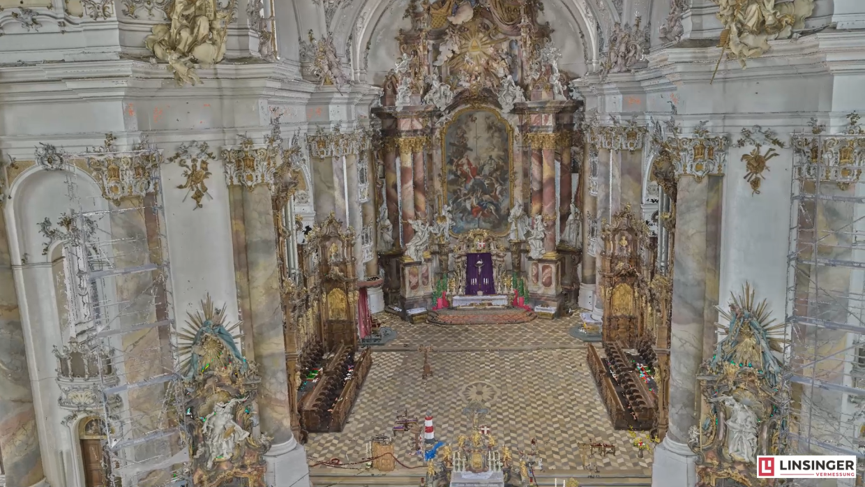
Basilika Ottobeuren (Copyright: Linsinger ZT GmbH Vermessung)
Is there one project that has remained particularly memorable for you?
One especially formative project was the Munich Residenz, together with the Basilica of Ottobeuren. We worked on the Residenz over a period of seven years, returning repeatedly for different phases of the project.
Why did it take seven years?
The challenge was that there was virtually no existing documentation. Our task was to create this foundation in the first place – for restorers, architects, stonemasons and structural engineers.
To achieve this, countless sectional drawings and a total of 16 floor-plan levels had to be produced. The sheer scale of the complex also made the project extremely demanding – after all, the Residenz is the largest city palace in Germany. Although the project is fundamentally complete, additional surveys continue to be required following alterations and renovations.
Which other well-known projects have you worked on?
Our projects include Neuschwanstein Castle and the north portal of Cologne Cathedral, among many others. We primarily work within the DACH region, but we are also regularly active internationally.
For example, we worked on the historic fortress walls in Baku, Azerbaijan, and surveyed the Buxara Karvansarayi and the Gasimbey Hamam. We have also worked in China, where we surveyed the Shuilu Temple. In particular, the delicate clay figures were recorded using a close-range scanner with a resolution of one hundredth of a millimetre.
In Bolivia, we even documented a palaeontological site: the world-famous dinosaur tracks on the approximately 1.5-kilometre-long rock face of Cal Orcko near Sucre, the largest collection of prehistoric footprints in the world.
What importance does exhibiting at trade fairs have during economically difficult times?
Precisely in such periods, it becomes especially important. We use the trade fair both to establish new contacts and to maintain existing relationships. Very often, new projects emerge from these long-standing connections.
Overall, exhibiting at the fair holds great significance for us – professionally as well as economically.